


A Map of Kent 1769
A Survey of the County, first published in 1769
The London bookseller Andrew Dury and the engraver John Andrews set out in 1750 to create a fine new survey of Kent, and published the resulting map on twenty-five sheets as a large folio volume in 1769. The generous scale of two inches to the mile enabled them to boast that their extraordinary map showed every road, lane, church, town and village, as well as ‘Noblemen and Gentlemen’s seats, Houses, Gardens, Cottages, and everything remarkable in the County’.


““... the most skilfully engraved and beautiful of all the historic maps of Kent””
The geographical position of Kent has given it an extraordinary strategic and economic importance since the earliest times. The particular importance of Canterbury, the seat of the Primate of England, was highlighted by the cartographers of our 1769 map by the inclusion of an entire additional plate dedicated to the city, showing its streets and houses in unprecedented detail.
This mapping of ‘The Garden of England’ is also a survey of a county of supreme maritime importance. When the map was created, the Kent ports of Chatham and Sheerness in the Medway and Woolwich in Deptford on the Thames shared the burden of housing the Royal Navy. This is perhaps the reason why the map, unusually, depicts all the sandbanks and charted depths of the coastal waters.
Dury and Andrews surveyed great houses as well as farms and cottages, rivers and coastline as well as the gardens and names of individual home-owners. The scale of two inches to one mile shows, in fascinating detail, the land, the coast and the social fabric of the time. A glimpse at any of the map sheets is to step back in time and be absorbed into an exploration of 18c Kent.
Original copies of A Map of Kent are rare. King George III was one of the original subscribers, and a copy is kept in The Royal Collection. A few more are in private libraries and collections.
The set of coloured maps are presented in a Solander case, and the edition is limited to 500 hand-numbered copies.

-
The first task was to find a complete copy to reproduce. Enquiries led to a fine copy in the Royal Collection (the copy originally purchased by George III) and just a handful of others, all in private collections. Then we struck lucky: a bookseller in Folkestone had a complete uncoloured copy of the original edition, which we were able to acquire. The precious book was disbound by a specialist craft binder, enabling the leaves to be scanned with the highest fidelity required for such incredibly detailed images. As the copy was uncoloured, we then commissioned a cartographic specialist to add colour to each scan, creating the effect of hand-colouring – a process that was itself a major undertaking. The map sheets are printed on paper chosen as a perfect match to the original for shade and texture.
-
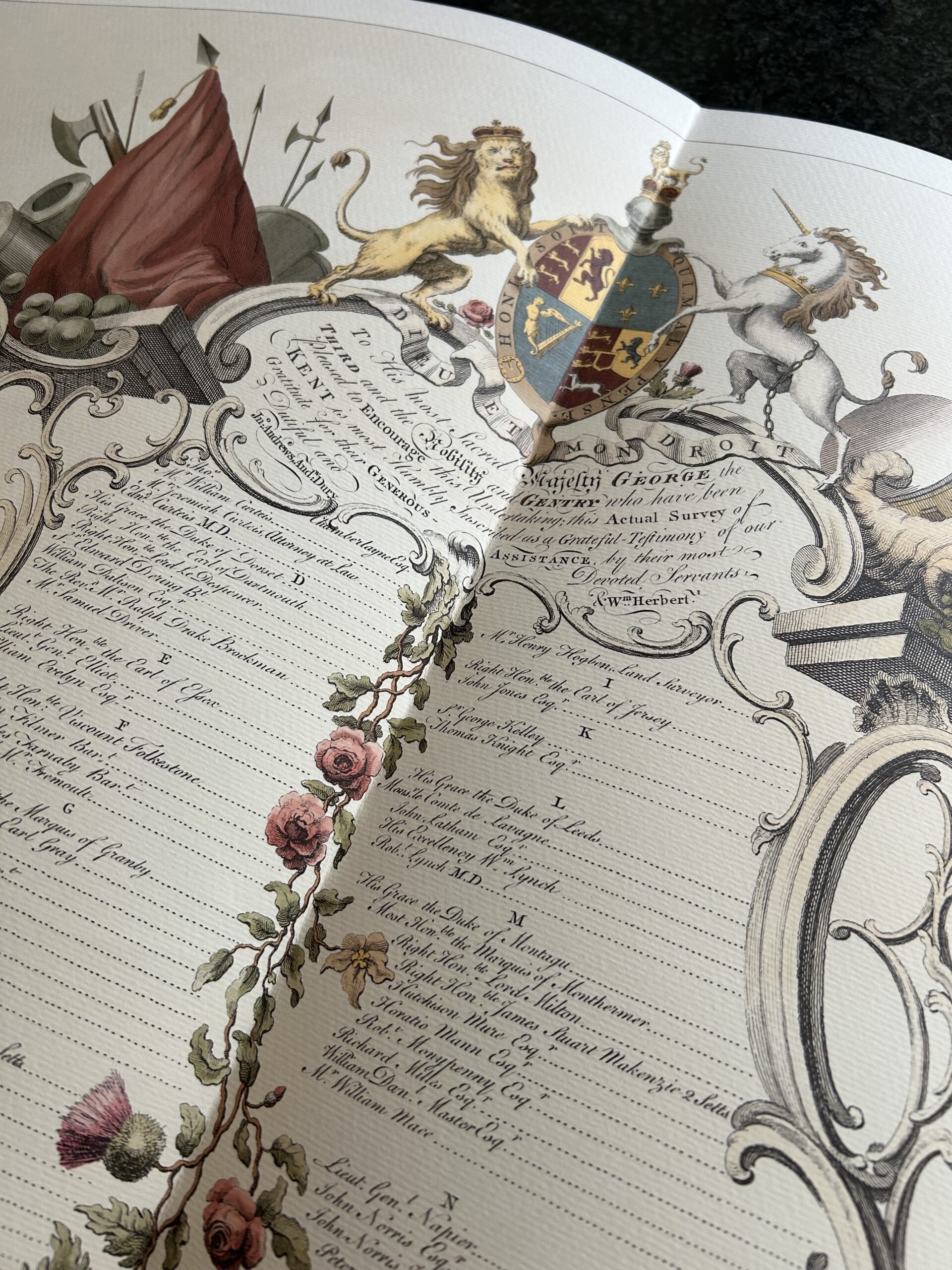
Andrew Dury and John Andrews financed their great endeavour by signing up subscribers to the Map. Their names are printed into the magnificent original subscriber’s page which is reproduced in the facsimile. The list is headed by King George III and the Dukes of Gloucester and Cumberland, indeed The King’s copy remains in The Royal Collection to this day. The collection of over 100 subscribers includes the Archbishop of Canterbury, Thomas Walpole and, the only woman on the list, the Duchess of St Albans. It is a Who’s Who of the aristocracy, politicians, gentry and churchmen of the time.
-
The Publishing Team for A Map of Kent 1769 are Henrietta Pearson of Addison Publications and Joe Whitlock Blundell, former Production Director of The Folio Society.
The use of traditional skills makes this collection of maps a library standard treasure. An original copy of A Map of Kent 1769 has been unbound, scanned, and then colouring added before being printed at actual size on Chagall Bianco paper from the Cordenon Mill. The paper is archival and of a fine quality.
A Map of Kent 1769 is presented in a hand-made Solander case with gold embossing on both spine and front board. It is covered in brown buckram for strength and durability. Each set of maps is supplied with an additional map for framing, a frame and the introductory text volume by Peter Barber. The set is limited to 500 copies, hand numbered on the inside of the case. The design of the Solander case is by David Eccles.
Specification
A Map of Kent is a limited-edition publication of 500 hand-numbered copies.
Solander case size: 55 x 39 x 6 cm
Map sheets open to 53 x74 cm printed on Chagall Bianco paper by Cordenon.
28 double-page spreads including index map, map of Canterbury and Subscribers’ page
Presented in a buckram-bound solander case with embossed front board and spine, with 25 x 19 cm commentary volume by Peter Barber, former Map Librarian of The British Library.
The purchase includes an extra loose unbound map sheet of your area of choice.